»Events Calendar»Highway Conditions»Highway Webcams»Movie Theaters»Weather Forecast»Reno Webcams»NewToReno Blog»Site Map |
Take a Hike on Browns Creek Trail
Mountain Bikes and Horses also WelcomeSearch NewToReno

May is Older Americans Month |
|
|---|---|

|
Events and activities for seniors all month. |
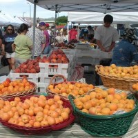
Farmers Markets |
|
|---|---|
|
Shop for fresh fruit, veggies, and other goodies. |
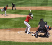
Reno Aces Baseball |
|
|---|---|
|
Fun at the ballpark with the Reno Aces. |
Brown's Creek Trail is a moderate hiking and biking trail in the forest of south Reno. The trail is suitable for families and children. For information about more Reno area trails, go to "Reno Area Hiking and Walking Trails."
About Brown's Creek Trail
Brown's Creek Trail provides a pleasant hike in the Galena Forest / St. James Village area at the southern edge of Reno's urban area. It is a loop trail that takes hikers, bikers and horseback riders through a forest area just above the open desert landscape to the east. The trail initially climbs moderately for a little over a mile. Near the top, you get views of Reno and across Truckee Meadows. Since you are hiking mostly in the trees, there are plenty of shady spots to take a breather.
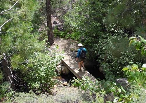
Brown's Creek Trail hiker crossing a bridge on the loop section of the trail. Photo © Stan White
From the top, the loop takes you down into the canyon of Brown's Creek and around to the trail you came in on. Brown's Creek usually has water year around. There is interesting vegetation, birds and other wildlife, and aspen groves down here, with Slide Mountain rising above the head of the canyon. After hiking the loop, you return to the trailhead parking area by descending the same trail you came in on.
Brown's Creek Trail is open to hiking, mountain biking, equestrians, dogs (on leash), and winter snowshoeing. There are areas of private property nearby, so please stick to the trail. Motorized vehicles are not allowed.
Hiking Brown's Creek Trail
The first 1.2 miles of Brown's Creek Trail climbs through open forest to the top of a ridge. This is the section most suitable to biking and equestrian use. Near the top, look to the south for some good views of Reno, Sparks, and beyond.
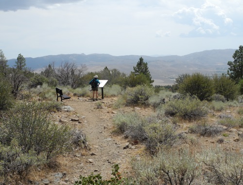
At the top, be sure to take the short spur trail to a vista point with an interesting interpretive sign about the former family attraction named Sundown Town. It's a bit of local history that's not well known. There are views into Washoe Valley from here and there is a bench where you can relax and perhaps enjoy lunch.
A short distance further, you come to the intersection with the loop that descends to Brown's Creek. You can go either way and I have no preference. Two small foot bridges span the creek, one on each end of the loop. There is shade among the pine and aspen trees along the bottom and sides of the canyon. During spring and early summer, a variety of wildflowers color the slopes. Around the loop is about 2.3 miles. The total mileage of Brown's Creek Trail is about 4.8 miles.
Brown's Creek Trail scenic viewpoint with sign about Sundown Town. Photo © Stan White
Reaching the Brown's Creek Trailhead
From Reno, take I580 / U.S. 395 south to the Mt. Rose Highway (Nevada Route 431). Go west (toward Lake Tahoe) for about 4 miles. Just after passing the the Galena Creek Visitor Center on the right, turn left on Joy Lake Road. Follow the road down for about 1.5 miles. The trailhead parking area on the left is clearly marked with a sign and has an informational kiosk. Look directly across the road for a sign at the beginning of Brown's Creek Trail.
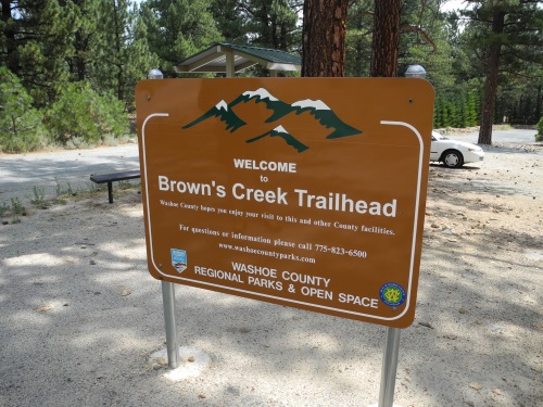
Trailhead and parking for Brown's Creek Trail in south Reno, Nevada. Photo © Stan White
Sponsored Links
Sponsored Link
| Share NewToReno(dot)com | |||||
|---|---|---|---|---|---|
»Home »Contact Us »About Us »Privacy Policy »Disclaimer »Site Map
Copyright © NewToReno(dot)comTM